


California (Part One)
Pre-John Muir Trail

6/13/22 – 6/21/22
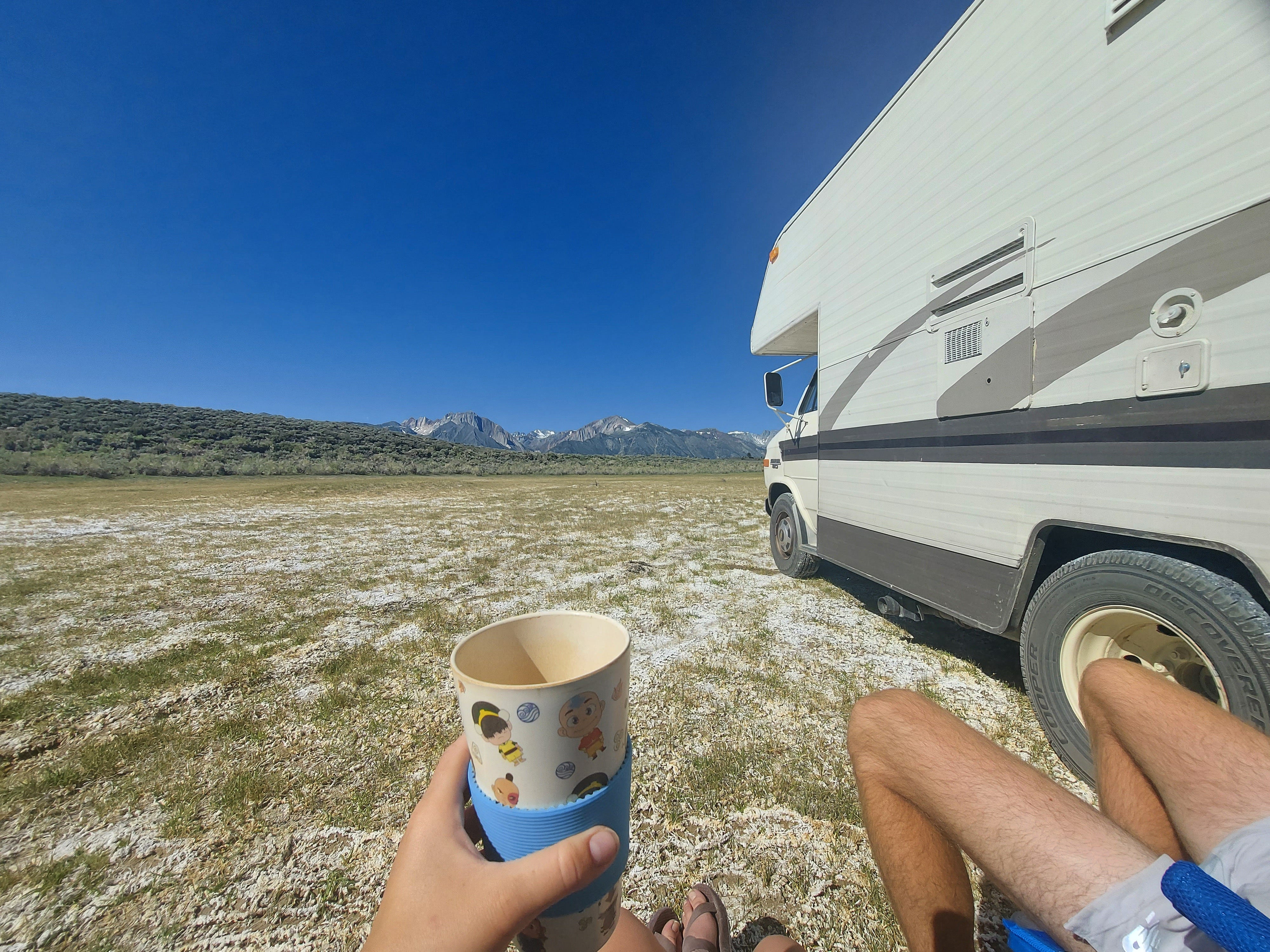
Just a fair warning to you readers that these journals are about to get a lot longer than usual, as we were spending a lot more time in states from this point forward. We thankfully made it safely to California. Our permits to hike the John Muir Trail started on June 22nd, so we were going to spend some time vanlifing in the Eastern Sierras to acclimate to the elevation and prepare for our hike. For the most part, there is one main road that connects all of the cities on the Eastern side of the Sierras, and it's highway 395. By the start of our hike, we knew 395 like the back of our hands. To the north, we traveled through Lee Vining and Mammoth Lakes and then took the road south to Bishop, Independence, Big Pine, and Lone Pine, which is where our thru-hike ends and the home to Mt. Whitney.

For those of you who may not be familiar, the John Muir Trail is a 211-mile thru-hike through the Sierra Nevada mountains. It spans all the way from Yosemite Valley to the top of the tallest mountain in the contiguous United States, Mt. Whitney (14,505’). Our permits had us starting in Tuolumne Meadows in Yosemite and hiking southbound to Mt. Whitney, so we were actually missing the first 20 miles or so of the trail because the permits are so competitive (we will go back for those 20 miles someday)! Now, for you to understand our motives for our time in the Eastern Sierra towns before the hike, you first need to understand some things about the hike itself. There is 45,000 ft of elevation gain overall, which makes the trail very difficult. On average, it takes about three weeks for people to finish. Not only is the terrain and distance difficult for this hike, but so are the logistics. Since the sierras are so remote, there are not many options to resupply food and gear. We opted to pack our own boxes and leave them at resorts for us to pick up along the way, which means we will have to hike off-trail to retrieve them. So, while we were doing nothing but waiting for our hike to start, we packed our two resupply boxes and hand-delivered them along highway 395. Another focus of our stay in the Eastern Sierra towns was to acclimate to the elevation. There is a huge risk of altitude sickness on the John Muir Trail since it’s possible for you to gain multiple thousands of feet of elevation in a single day of hiking. Neither of us had been hiking at elevations like this before, so we didn’t know how our bodies were going to react, especially since our hometown sits at an elevation of 413’.

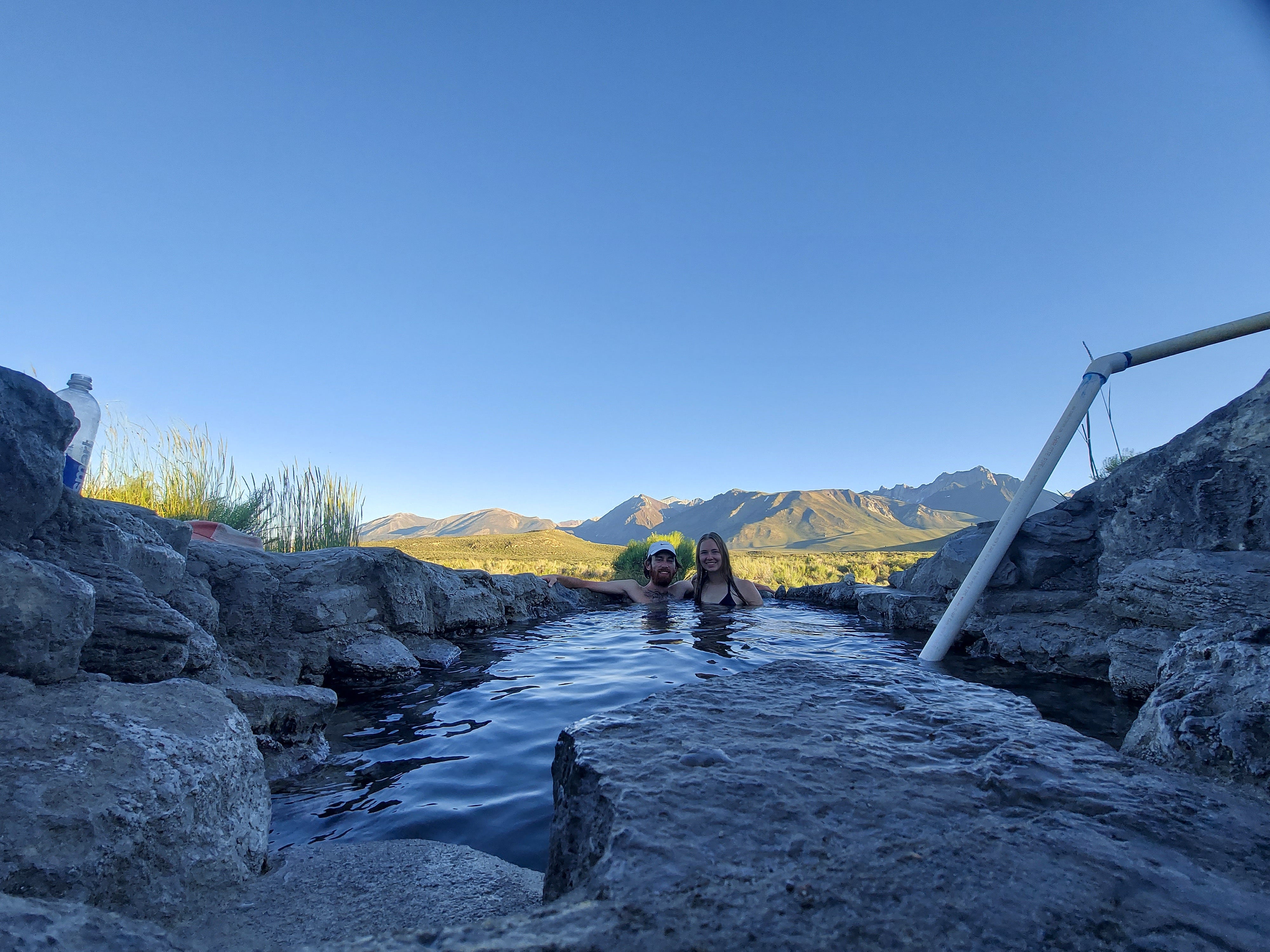
We stayed at a boondocking site not far from Mammoth Lakes that had access to free, natural hot springs. It is definitely one of my favorite sites we have ever stayed at. We had a whole natural hot tub to ourselves and got to watch the sunset on the mountains that we would soon be hiking through. We talked a lot about our plans and hopes and dreams to gain on this journey. It was the first time we had ever seen the Sierras, and a moment I will never forget.

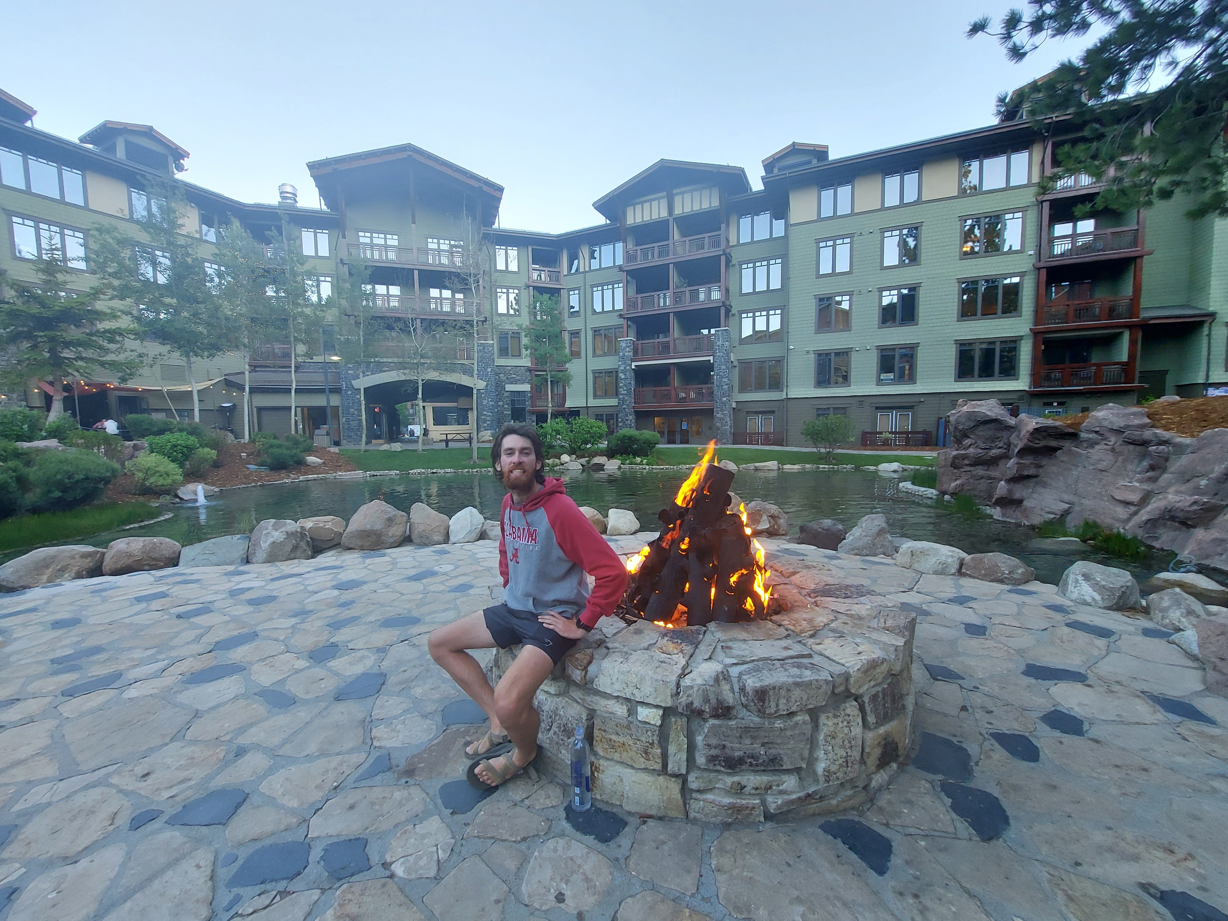
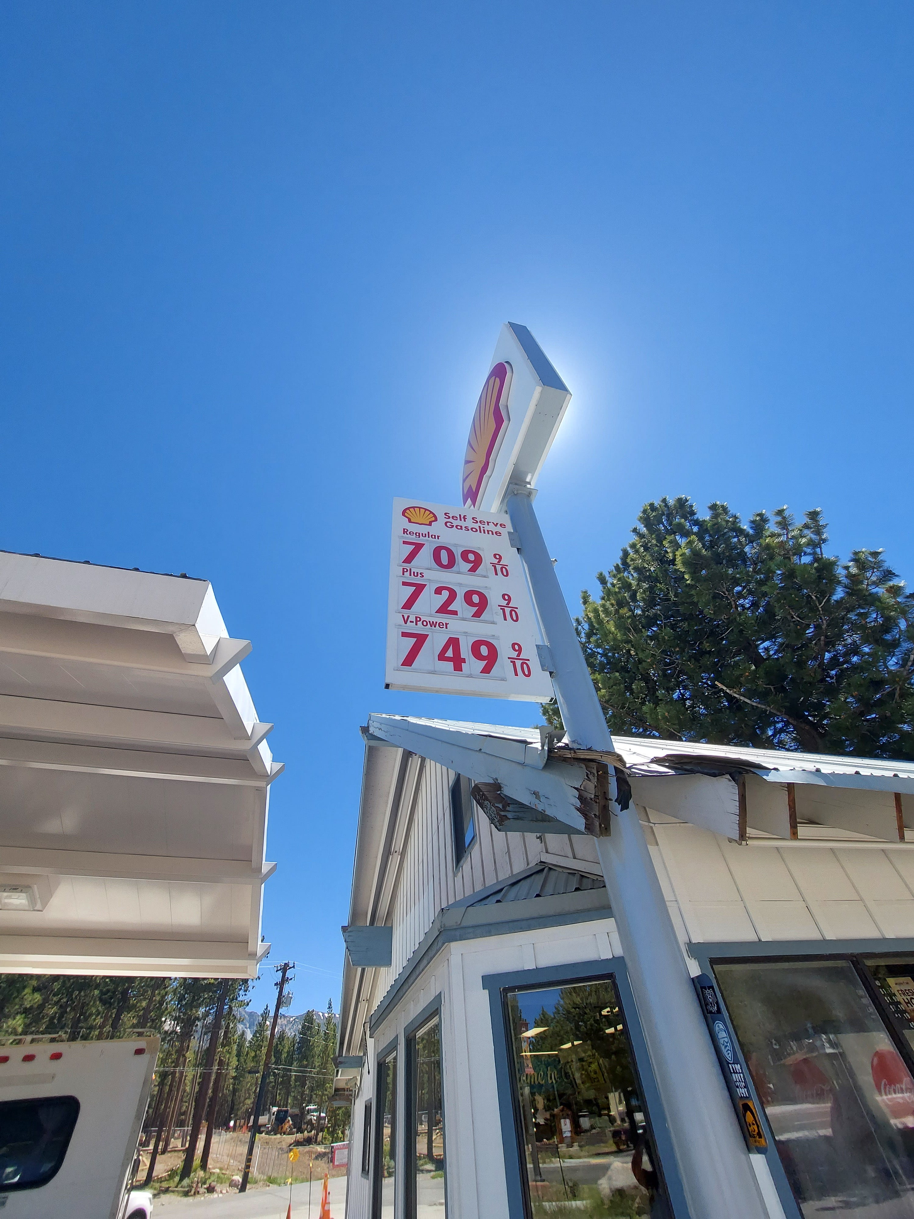
Mammoth Lakes was our first stop on 395 proper. It is a small ski town where we spent a lot of our time before the hike because it had the most gear shops and grocery stores for us to accumulate any last-minute things we would need. They have a free trolly you can take and a little town square that hosts all kinds of summer activities, such as live music and yoga. What we did not enjoy so much here were the gas prices. They were the highest we had seen at $7.09, but not the highest to come. This town clearly valued the outdoors and gave me vibes that I only expected to get in places like Colorado or Washington. Everyone in this town was either into hiking, backpacking, skiing, snowboarding, mountain biking, climbing…or all of them! This type of community is one that I never had growing up. I have always had an appreciation for the outdoors and nature, which is why I got a degree in ecology and environmental science, so I could conserve and protect these beautiful places. It was an appreciation not many people back in my hometown understood. Until late in college, I didn’t really have friends who wanted to go hiking and camping on the weekends with me. And by the time we are all in college, we didn’t have as much time to do those things anymore anyways. But Mammoth Lakes showed me there are communities and areas all over the US where you can find people who are like-minded and enjoy those activities as much as Nick and I do.
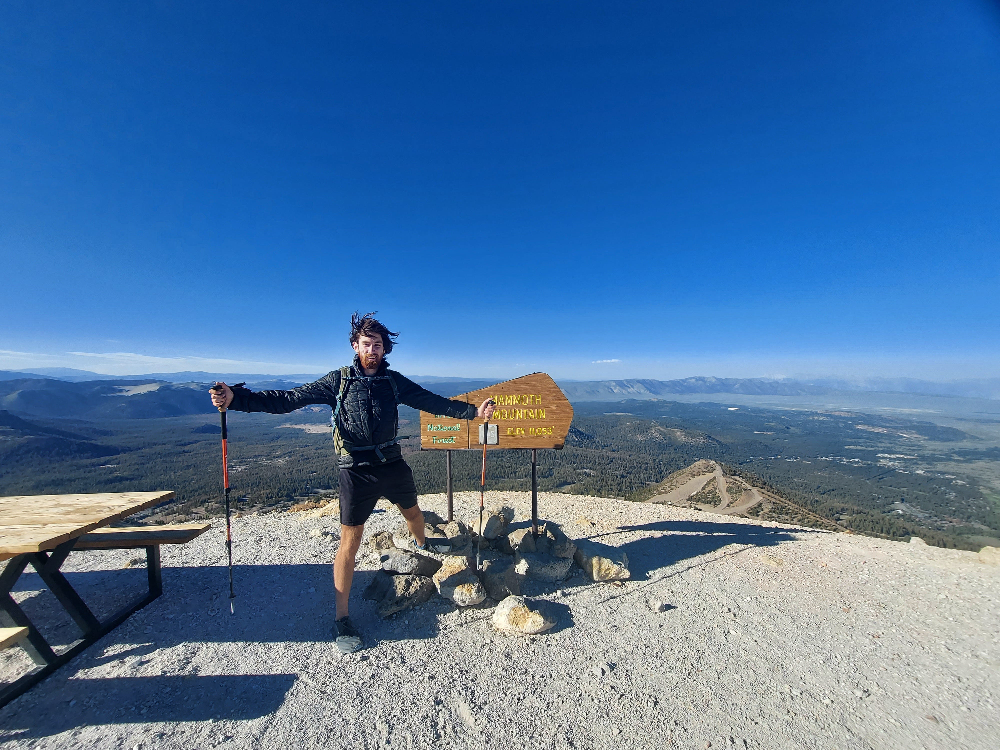
One of the first things we did in Mammoth Lakes was climb Mammoth Mountain. This is the ski hill near the town, which stands at 11,053’, by far the tallest mountain I had ever climbed. It also continues to be one of the scariest mountains I’ve ever climbed. The weather was sunny and a bit crisp, so we decided it was a good day to summit. Less than one mile from the top, the wind started to pick up to about 40-50mph. On the ground, this may not have been dangerous, but walking on the ridge of a mountain with patches of snow was a different story. I was terrified, but we were very close to the top, so we kept pushing and made it to the summit where we took pictures by the sign and immediately seeked shelter behind the only bush to get out of the wind. This moment was bliss. We did it. We had conquered our first mountain in the Sierras. A tall one even. I could see many more of the sierras from here, a place I would call home for 17 whole days. I felt like I was on top of the world…but that feeling ended quickly when I realized I still needed to go back into the wind and hike the rest of the way down.

We were planning on dropping our first resupply at Red’s Meadows Resort, which is right outside Mammoth Lakes. Something we learned very quickly while preparing our food box is that there are no Wal-Marts in the Eastern Sierras. So, when we stocked up on our backpacking food at the Vons and Grocery Outlet in Mammoth Lakes, it ended up probably being twice as expensive as we expected. Lesson learned: not everywhere has a Wal-Mart. Our poor planning didn’t stop there. You see, Illinois winters are intense, but they’re nothing compared to places like Mammoth Lakes. The winters are so bad here that they close whole roads, including the one and only road that leads to our resupply, Red’s Meadow, which was not something that we even considered being an issue. Before knowing the road was closed, we attempted to drive to the resort on our own to find the road blocked and a maintenance man working on the gate. We asked him about it and he said the road was opening for the summer tomorrow…we got SO lucky here. We also learned that private vehicles are not allowed on this road unless it’s before 7AM, and we had to get a shuttle ticket. We learned very quickly why this was the case.
The next day we hopped on the first shuttle and rode into the resort. The road was twisting and winding all around the ridge of the mountains, and definitely would have been very sketchy in Winnie. It also went down to one car wide in multiple spots where the bus drivers had to use radios to communicate to each other that they were passing through. When we dropped off our box at the resort, they were restocking the little store they had for campers and thru-hikers coming in. We saw many early Pacific Crest Trail (PCT) and John Muir Trail (JMT) hikers coming through to resupply and order a burger from the kitchen. They were the real deal and got us even more excited to be one of them in the next few days.
It was time to leave Mammoth Lakes and drop off our second resupply at Parchers Resort in Bishop. This is not a popular place to resupply on the trail and was definitely going to be the harder of the two to retrieve on the hike. We didn’t spend much more time here and headed straight to Lone Pine.
Another aspect that makes this trail difficult is the shuttle system. Since this is a thru-hike, it means you are starting at one end of the trail and ending at another, leaving your car at one of them. We were very nervous about this because our car isn’t just our car, it was our home. So, we opted to pay the Film Museum in Lone Pine to park our car in their lot for the 17 days we were on trial, which is honestly one of the only options available, especially for a larger vehicle. Since Lone Pine is the end of the trail, this meant we would have to shuttle on buses to the start. This took a lot of research and planning to get right because we actually had to take two different buses to get from Lone Pine to Tuolumne Meadows. Luckily, there are many forums, books, and Facebook groups that have this information.
We arrived in Lone Pine at the McDonald’s in hopes of some free WiFi and outlets. Although this McDonald’s had neither, what it did have, was our first view of Mt. Whitney. I definitely did not expect my first sight of the finish line to our hike to be from the parking lot of a McDonald’s but it still amazed me as much as if it were anywhere else. There she was, the tallest mountain in the lower 48, taunting us from above. She honestly didn’t look too scary from down here, and I wondered how many people were at the summit right then.
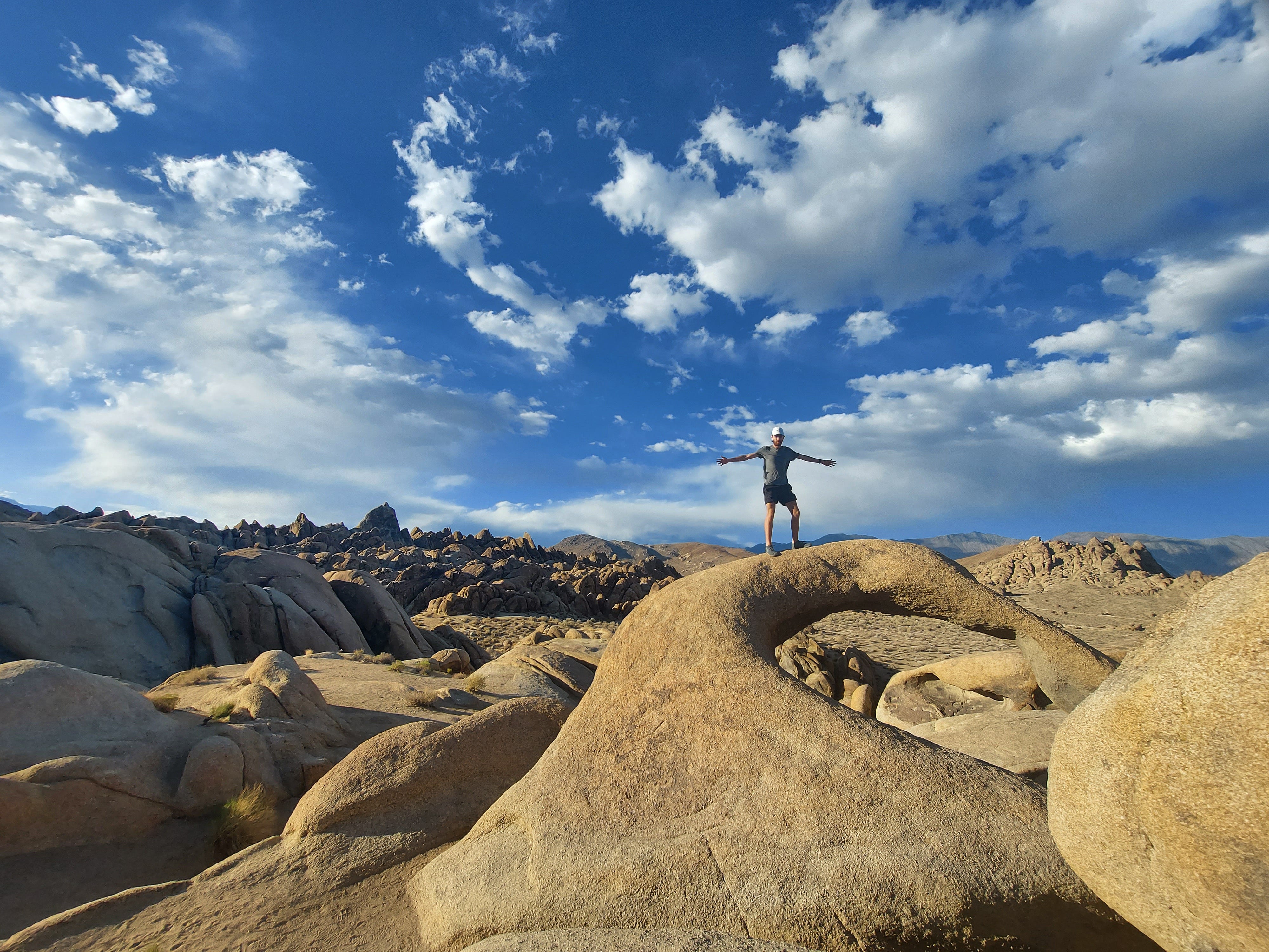
For the two days before our shuttle left Lone Pine, we stayed on BLM land in the Alabama Hills eating as much as we could and stretching our legs. We also had a great view of Mt. Whitney from here, and I could look at her and appreciate her whenever I wanted. The Alabama Hills reminded me a lot of the Elephant Rocks back home. Lone Pine California is considered the desert, and the hills look flat against the sharp contrast of the high sierras in the distance. I couldn’t wait to be on the other side of those mountains.
I don’t know what I was feeling at this point. Probably all the feelings. Excited to start this journey, nervous I was going to fail, but yet, confident I would finish at the same time. What I was most worried about was the lack of communication I would have with my family. Nick and I were irresponsible and did not have any satellite GPS to take with us on trail, so I basically accepted that I wouldn’t hear from my family for the whole 17 days. I wasn’t scared about getting hurt and needing to contact them, but I was scared about something happening at home and not being able to know about it. This is something I thought about every single day on trial.
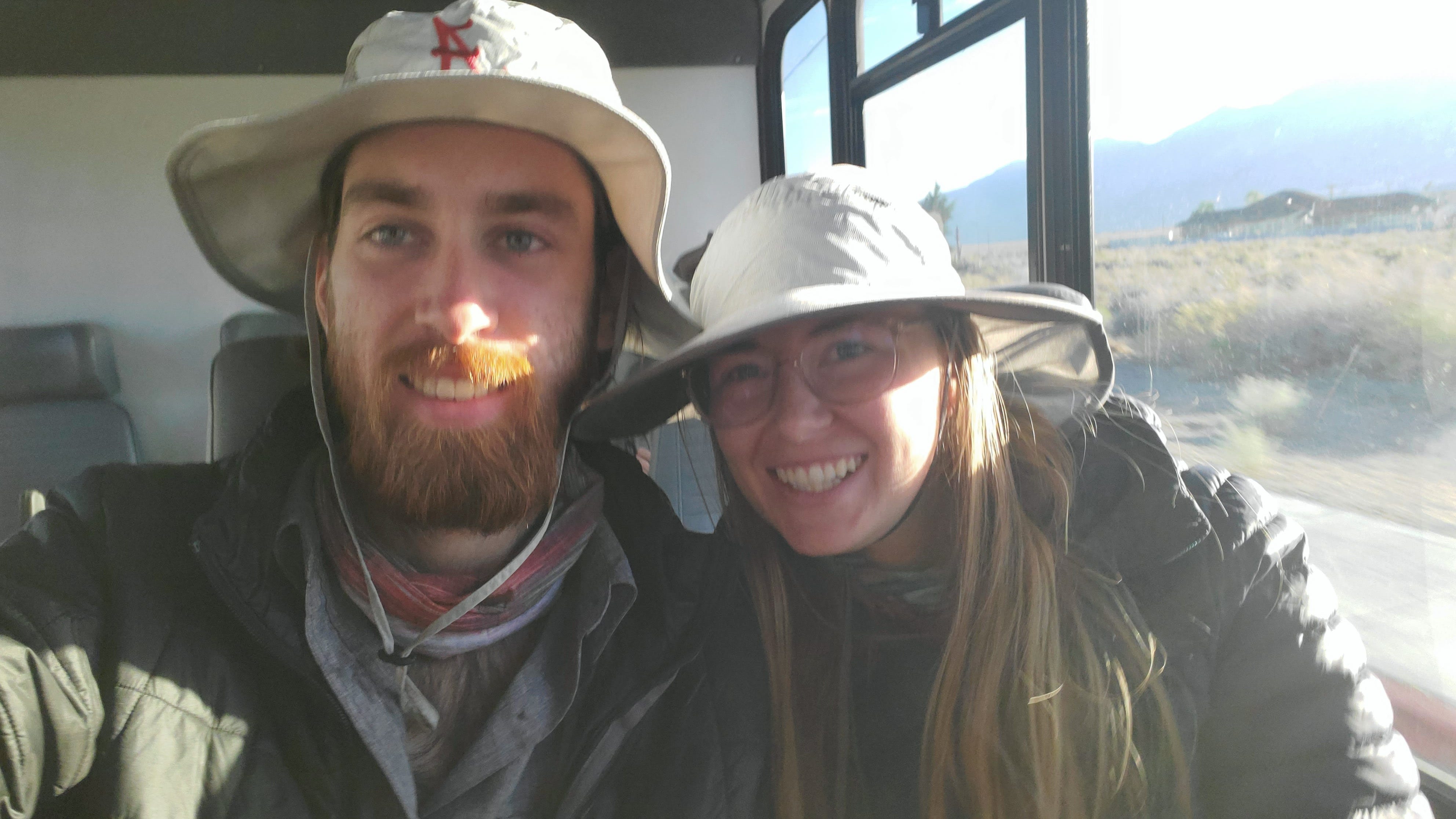
Today was the day. We woke up bright and early to park Winnie at the museum, where she would stay for the entirety of our hike, to catch our bus, again, at the McDonald’s. While we were waiting, another group showed up with their gear to catch the bus as well. Their names were Jim and Phil, two older gentlemen from LA. They were taking the bus all the way to the true beginning of the trail in Yosemite Valley, so we didn’t expect to see them on trail at all (spoiler alert, we did!)
As the bus rolled up, I took one last look at Mt. Whitney and hoped that when I got to the top in a couple of weeks, I would be able to make out the McDonald’s parking lot from above.
Just watch where you are stepping all the way on the trail. Merry Christmas from Madison Co., IL